The Kalamazoo River Watershed Council provides access to a variety of the latest plans for managing the watershed to improve and protect water quality. These plans have been developed by a variety of organizations with input from agencies, stakeholders, and other partners. They outline strategies that can be used to meet water quality and environmental goals, and serve as a collective “road map”, helping to identify priorities for restoring and protecting the watershed and water quality of our streams and rivers.
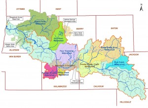
In addition to the Kalamazoo River Watershed Management Plan which addresses priorities for the watershed as a whole, there are individual “subwatershed” plans for many of the subwatersheds found within the the 2000+ square miles of the Kalamazoo River watershed. Links to these plan also are provided here.
Plans
Watershed Management Plans
Watershed Management Plans within the scope of the Kalamazoo River Watershed Council include:
- Kalamazoo River Watershed Management Plan (2015 UPDATE) [text] [attachments] [Davis Creek appendix] [Swan Lake appendix]A watershed-wide road map for reducing non-point and other sources of pollution to the Kalamazoo River
Subwatershed Management Plans
- Rabbit River Watershed Management Plan (2009)
- Upper Rabbit River Watershed Management Plan (pdf)
- Gun River Watershed Management Plan (2024)
- Four Townships (Gull & Augusta Creeks) Watershed Management Plan (2017 update)
- Portage and Arcadia Creeks Watershed Management Plan
- Davis Creek Phosphorus Reduction Study (pdf)
- Battle Creek River Watershed Management Plan (2004)
- Kalamazoo River Ceresco Reach Watershed Management Plan (2012)
- Rice Creek Watershed Management Plan (2004, plan and site assessment spreadsheet)
Kalamazoo River/Lake Allegan Phosphorus Total Maximum Daily Load (TMDL)
- Kalamazoo River/Lake Allegan Phosphorus Total Maximum Daily Load (2001) [full report]
Limits on the amount of phosphorus allowed to enter Lake Allegan and the Kalamazoo River
Remedial Action Plans (Kalamazoo River Area of Concern)
Stage 2 Remedial Action Plan Kalamazoo River Area of Concern (2012) [full report]
An update on the actions needed to restore Beneficial Use Impairments (BUIs)
Fish and Wildlife BUI Restoration Plan (2009) [full report]
Official fish and wildlife habitat and populations restoration criteria for the Kalamazoo River
Biennial Remedial Action Plan Update (2007) [full report]
Periodic updates on recent remedial actions and assessments in the AOC
Kalamazoo River Remedial Action Plan (1998) [full report]
A plan to restore and protect beneficial uses in the Kalamazoo River Area of Concern[/x_accordion_item]
Watershed Assessments
Landscape Level Wetlands Functional Assessment (2015) [contact the KRWC for more information]
Map of the ecosystem functions wetlands historically and presently serve throughout the Kalamazoo River Watershed
Kalamazoo River Hydrologic Study (2008) [full report]
A hydrologic model used to better understand how water moves through the changing landscape
Kalamazoo River Fisheries Assessment (2005) [full report]
A report describing the characteristics of the Kalamazoo River and its biological communities[/x_accordion_item]
Kalamazoo River Watershed Land Conservation Plan
With input from local partners, the final criteria used to determine the conservation priority for individual parcels included existing land cover, wetlands, proximity to water bodies and conserved lands, presence of coldwater streams, and threatened or endangered species/habitat.
The analysis revealed eight subwatershed areas with the highest density of priority lands for conservation. The protection of these high-priority lands is the most important for improvement of water quality, the health of the Kalamazoo River, and ultimately Lake Michigan. The landscapes in these areas are extremely diverse, with everything from forested floodplains to prairie fen wetlands to coldwater trout streams.
Download the Executive Summary and Map (pdf) or the Full Plan Text (pdf).
The plan will be incorporated into the Kalamazoo River Watershed Management Plan and adopted by the Michigan Department of Environmental Quality. While the plan emphasizes the eight priority land areas, it is important to note that high priority parcels for conservation were identified throughout the watershed. We encourage local planning organization and conservation groups to contact us to discuss the results from your specific area.
Get involved with the KWRC by attending one of our many events!